Model type
Calculation
Maximum area / minimum area
Max – 1000 sq.km
Min – no limitations
Average time of request execution
About 5 minutes
Price
10 $ per 1 sq. km.
Overview
Model description
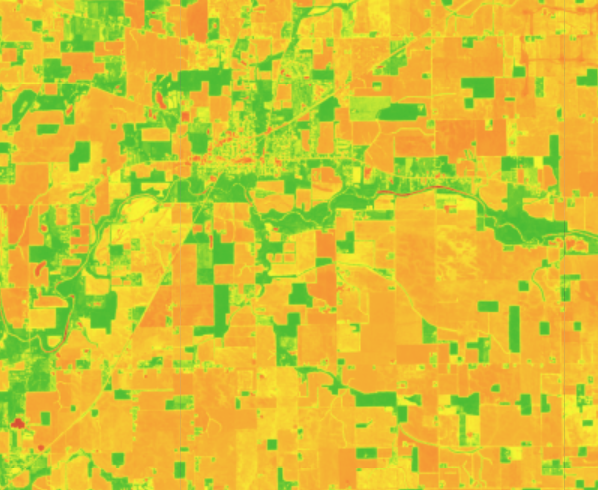
NDVI – allows to assess germination, growth, the presence of weeds or diseases, as well as to predict the productivity of the fields. Indicators NDVI allows you to clearly separate the vegetation from other natural objects. As a result, it is possible to obtain identify areas that need reseeding, application of plant protection products or fertilizers. The index is moderately sensitive to changes in soil and atmospheric background, except in cases of poor vegetation, and can be saturated in conditions of dense vegetation.
Selecting the date
To run the model, users need to select one date.
Output
The raster with pixels colored by NDVI values.
Available geographical region
Technical information
Technical description
The NDVI model is the calculated difference between the red and near-infrared spectrum. This produces a range of vegetation indices from low to high values, and the model calculates and assigns data to each pixel.
Spatial resolution
Spatial resolution: 10m per pixel
Input data sources
Optical: Sentinel-2
Accuracy
Thematic accuracy: variable, ~93%