
Model type
Classification
Maximum area / minimum area
Max – 1000 sq. km.
Min – 2 sq. km.
Average time of request execution
About 30 minutes
Price
50 $ per 1 sq. km.
Overview
Model description
The crop type detection service provides information on types and location of crops grown.
Classes
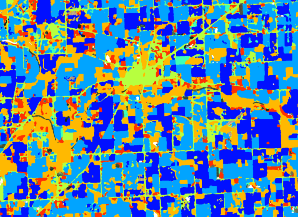
Corn, Soybeans, Fallow/Idle Cropland, Developed Forest, Grassland/Pasture.
Selecting the date
To run the model, users can choose one of two seasons – winter and summer.
The summer season starts on May 1 and ends on August 31.
The winter season starts on December 1 and ends on March 1.
Output
Raster with pixels colored by crop type and calculated crop area.
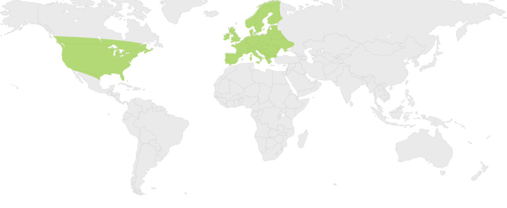
Available geographical region
Technical information
Technical description
The classification of crop types is performed by using spectral information and temporal information about crop development. With this information it is possible to separate accurately different crop classes over large areas. To identify the different crop types a long and consistent time series of satellite imagery is needed. The later in the season, the more accurate the identification of crops gets, as there is more information available and the vegetation differences are more clearly recognisable.
The Crop Type model uses a seasonal approach.
The season uses 4 months.
The model uses all available images during the growing season to ensure the best possible forecast quality. This is usually 10 to 30 satellite images from Sentinel 1 and 2.
Spatial resolution
Spatial resolution: 10m per pixel
Input data sources
Optical: Sentinel-2,
Radar: Sentinel-1
Accuracy
Thematic accuracy: variable, >90% for major crops and crop groupings (end of season)
Spatial accuracy: 1.5 – 2 pixels of input data