Model type
Calculation
Maximum area / minimum area
Max – 1000 sq.km
Min – no limitations
Average time of request execution
About 5 minutes
Price
10 $ per 1 sq. km.
Overview
Model description
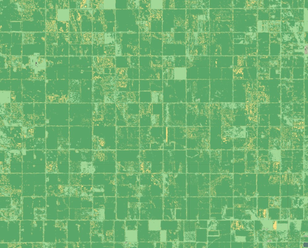
Determines the moisture index of the topsoil.
Selecting the date
To run the model, users need to select one date.
Output
The raster with pixels colored by moisture level for territories with vegetation (no water stress, low water stress, high water stress, drought.)
Available geographical region
Technical information
Technical description
The index is calculated based on NDMI and NDVi Sentinel-2 indexes. NDVI determines the vegetation level of pixels and NDMI detects the water stress for this vegetation level.
Spatial resolution
Spatial resolution: 10m per pixel
Input data sources
Optical: Sentinel-2,
Accuracy
Thematic accuracy: variable, ~92%