Model type
Detector
Maximum area / minimum area
Max – 1000 sq.km.
Min – 2500 acres.
Average time of request execution
About 30 minutes – 8 hours
Price
$250 per 1 sq. km.
$1 per 1 acre.
$2.5 per 1 ha
Overview
Model description
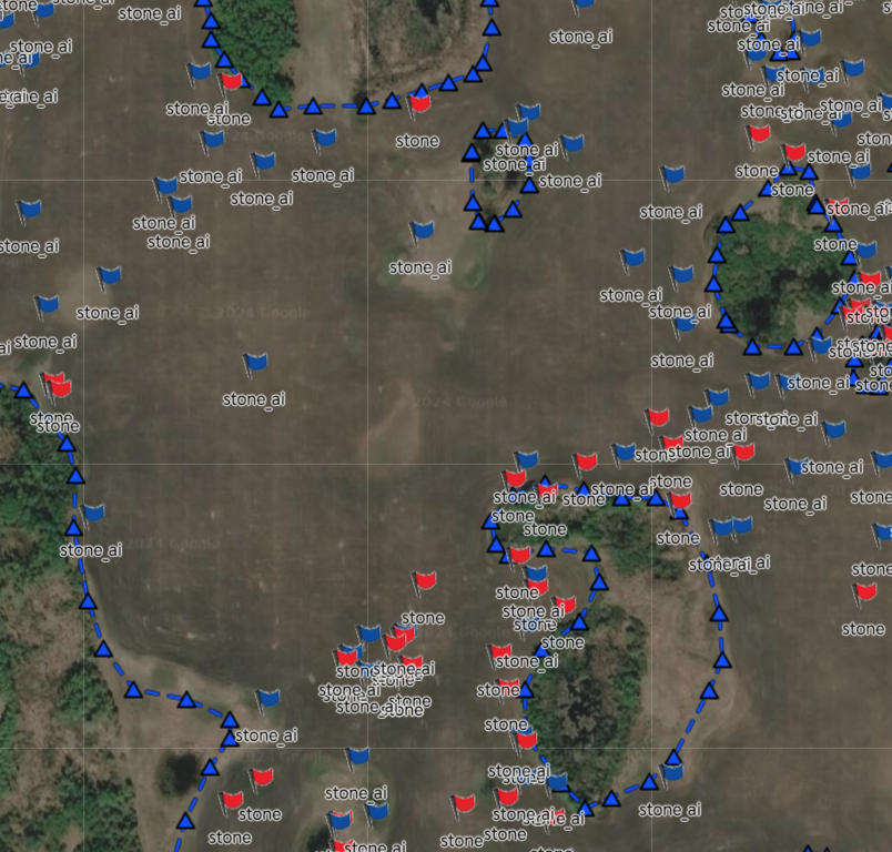
The model identifies and locates stones within video footage. It assigns precise coordinates to each detected stone, providing detailed information about their position.
This stone detection capability is integrated into the services offered by our Canadian partner, SAIRS. Ordering this model through SAIRS streamlines acquiring the analytics, making it easier and more efficient than ever.
The model is also capable of identifying stones from a specific predefined stone size to choose from: ≈15 cm, ≈20 cm, ≈25 cm, ≈30 cm, ≈35 cm, ≈40 cm.
Selecting the date
Instead of the date, the model needs the path to the Google bucket where the video is uploaded from the tractor’s camera. The tractor camera must contain the coordinates of the shooting. Users also need to select the size of the stone you are interested in detecting.
Output
A file with the extension .gpx with coordinate data for each detected stone, the file can be uploaded to the Garmin system any other system that supports .gpx.
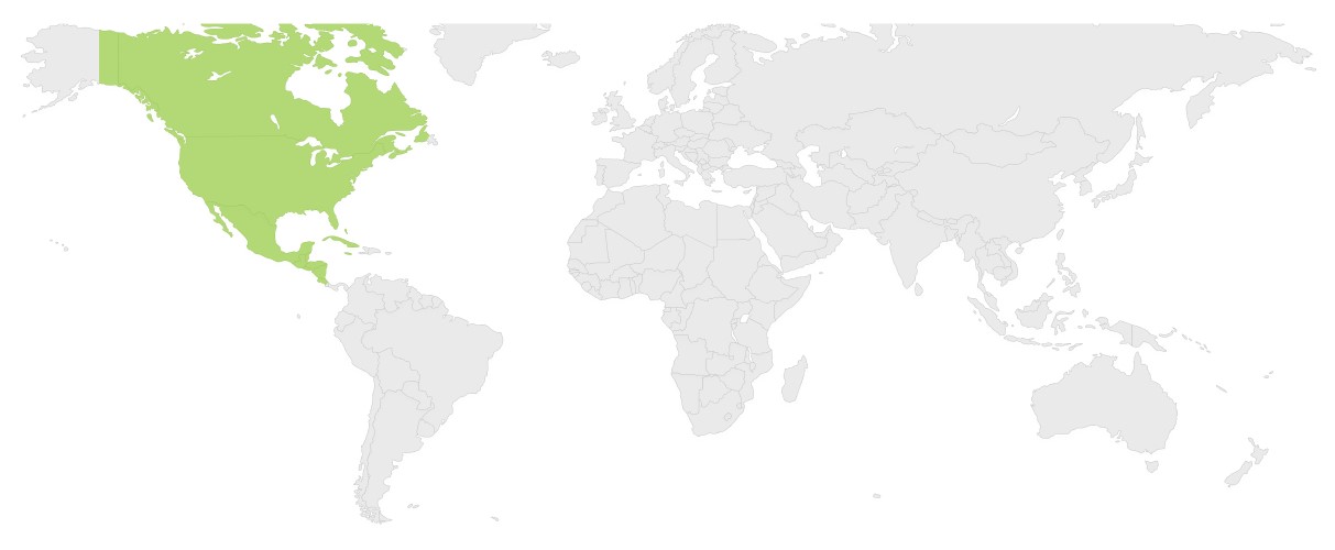
Available geographical region
Technical information
Technical description
The model uses CV and ML technology, which ensures higher quality results and the ability to adapt to specific regions and conditions.
Input data sources
Optical:
The camera resolution is 1920×1080, the camera should be mounted on the tractor at an angle of 20.
When using SAIRS services, everything is set up by our partner.
Accuracy
Thematic accuracy: variable, ~90%